All images / illustration
Congo country detailed editable map
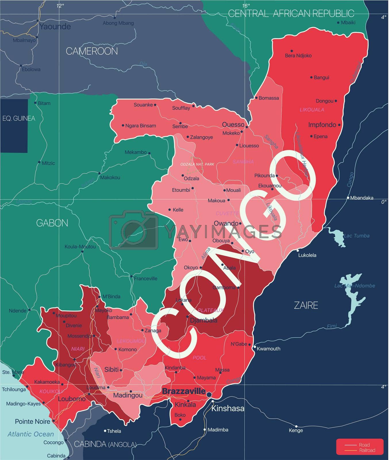
Congo country detailed editable map with regions cities and towns, roads and railways, geographic sites. Vector EPS-10 file
-
License:
Royalty Free License.
The license type determines how you can use this image.

Std. Ext. Print / Editorial Graphic Design Web Design Social Media Edit & Modify Resale Items 1 Unlimited Runs - Please see licensing information by clicking here
Vector
All images / illustration
Size Selection:
You can re-download any size after the purchase.
Want to Download? Subscribe and
Gain Access to Millions of Stock Assets:
Keywords
-
map
atlas
geography
cartography
border
africa
african
country
vector
illustration
cameroon
travel
congo
republic
outline
world
brazzaville
silhouette
abstract
central
owando
city
coastline
atlantic
globe
bangui
background
djambala
ocean
dolisie
kinshasa
libreville
mpamaoubangui
pointe-noire
atlantic ocean
sangha
central african republic
yaounde
destination
eps
world map
road
river
central africa
congo brazzaville
congo river
congo-brazzaville
impfondo
republic of the congo
kinkala