All images / illustration
Mali country detailed editable map
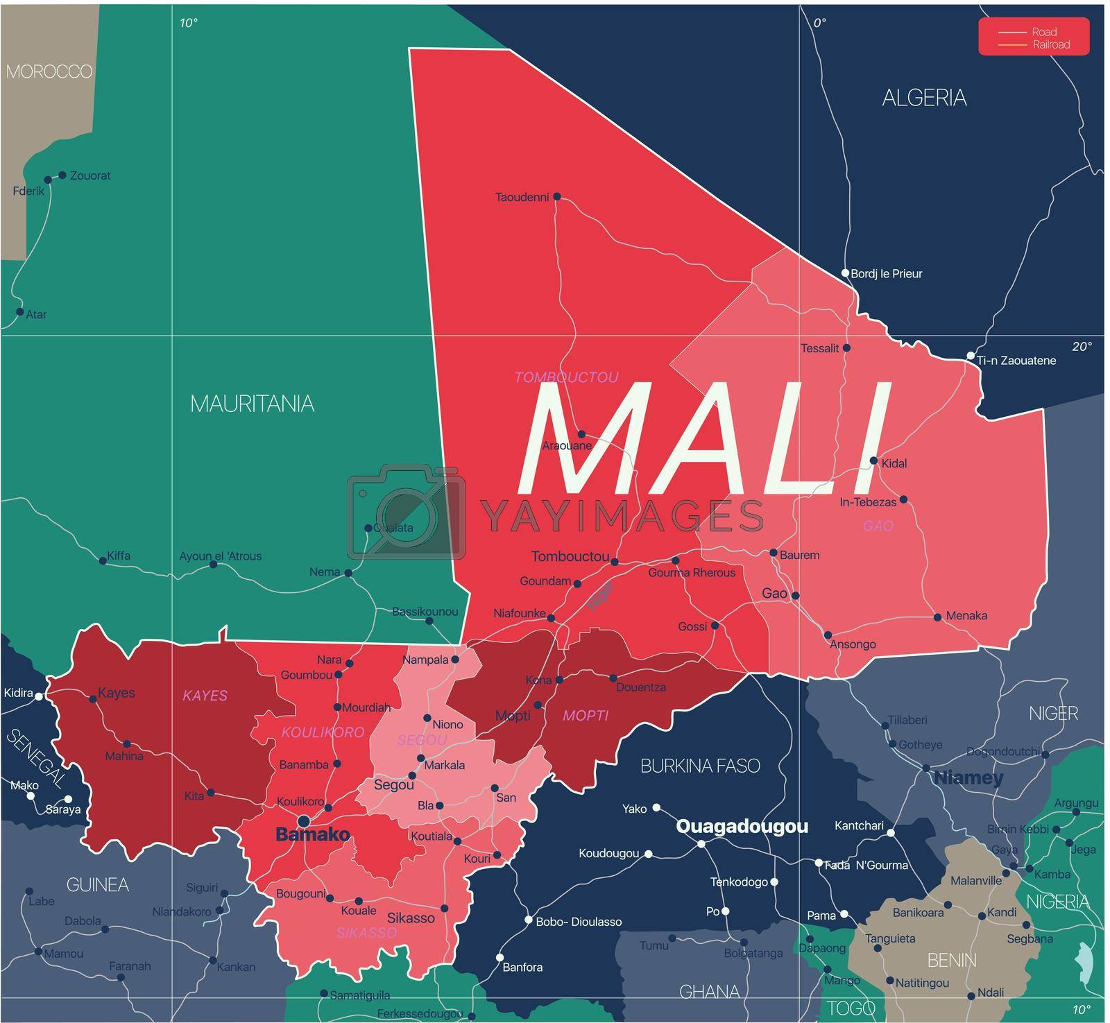
Mali country detailed editable map with regions cities and towns, roads and railways, geographic sites. Vector EPS-10 file
-
License:
Royalty Free License.
The license type determines how you can use this image.

Std. Ext. Print / Editorial Graphic Design Web Design Social Media Edit & Modify Resale Items 1 Unlimited Runs - Please see licensing information by clicking here
Vector
All images / illustration
Size Selection:
You can re-download any size after the purchase.
Want to Download? Subscribe and
Gain Access to Millions of Stock Assets:
Keywords
-
map
country
geography
atlas
africa
algeria
illustration
sahara
vector
travel
bamako
mali
political
guinea
mauritania
land
cartography
abstract
border
state
republic
niger
african
geographic
detailed
capital
road
graphic
world
background
western
west africa
nation
region
west
timbuktu
administrative
tuareg
topography
national
geographical
silhouette
burkina faso
ivory coast
politically
sahel
ghana
san
capital city
highways