All images / illustration
Seychelles islands detailed editable map
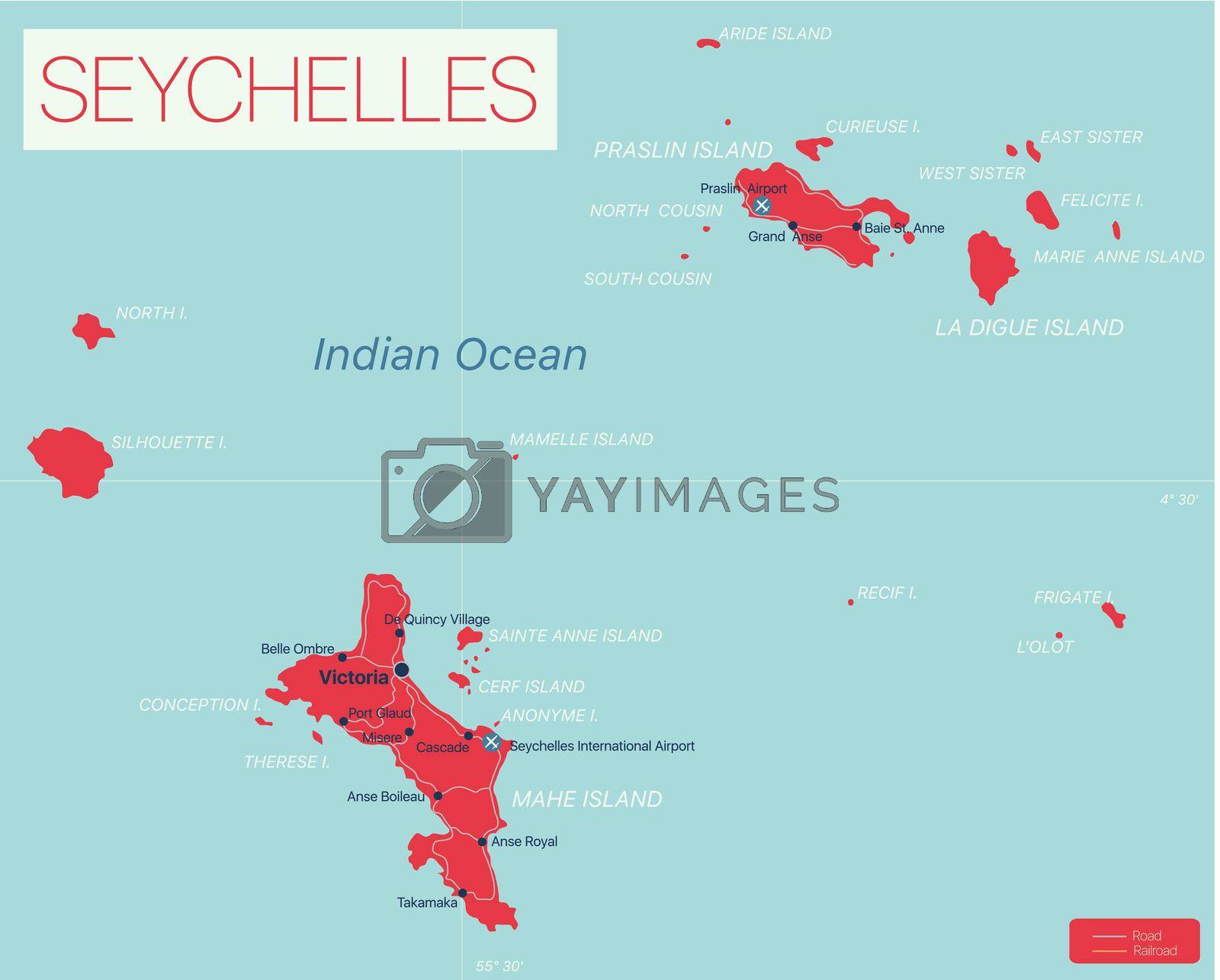
Seychelles islands detailed editable map with regions cities and towns, roads and railways, geographic sites. Vector EPS-10 file
-
License:
Royalty Free License.
The license type determines how you can use this image.

Std. Ext. Print / Editorial Graphic Design Web Design Social Media Edit & Modify Resale Items 1 Unlimited Runs - Please see licensing information by clicking here
Vector
All images / illustration
Size Selection:
You can re-download any size after the purchase.
Want to Download? Subscribe and
Gain Access to Millions of Stock Assets:
Keywords
-
geography
illustration
map
country
atlas
africa
island
cartography
seychelles
travel
vector
victoria
border
indian
abstract
ocean
capital
praslin
la
madagascar
political
inner
atoll
coral
archipelago
overview
indian ocean
beach
tourism
republic
coastline
outline
contour
curieuse
flag
commonwealth
silhouette
la digue
mahe
region
english
destination
red
saint
amirante
amirante isles
aride island
cerf island
government
capital city